Somba Tata Houses of the Atakora Which Villages Welcome Visitors and How to Arrange It
A practical guide to Somba Tata Houses of the Atakora Which Villages Welcome Visitors and How to Arrange It.

What makes a Tata Somba different from other earthen dwellings
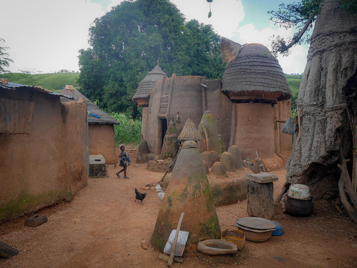
The Tata Somba, known to the Batammariba people as takienta or sikien, is not simply a mud house. It is a multi-storey fortified dwelling that functions as a self-contained family compound, built from banco, wood, and straw. The architecture follows a deliberate vertical logic. The ground floor shelters livestock and contains kitchens. An upper floor provides sleeping quarters. Above it all, a flat roof terrace serves as a workspace for drying harvests, punctuated by conical granaries that store grain.
This design reflects a defensive posture shaped over generations. The thick earthen walls and limited entry points once protected families and their food reserves during periods of inter-clan conflict. Today, the same structures remain private family homes, not monuments emptied for display. Understanding this living character is essential before planning any visit.
The UNESCO recognition and what it covers
In 2023, the Beninese portion of Koutammakou was inscribed as a UNESCO World Heritage Site, extending the original Togolese listing from 2004. The designation falls under criteria (v) and (vi), recognising the landscape as an outstanding example of traditional land occupancy and a testimony to the spiritual association between the Batammariba people and their environment.
The Beninese property is substantial, covering 240,658 hectares across three communes in the Atacora Department: Boukoumbé, Natitingou, and Toucountouna. Within this area, researchers have catalogued three distinct architectural types of takienta. The most numerous is the Otchaou, with 1,144 recorded examples featuring a vestibule, terrace, and flat roof. The Okpanri type accounts for 329 dwellings, ranging from single-terrace models to complex multi-terrace configurations. The rarest is the Ossori, with only 72 recorded, distinguished by granaries flanking the vestibule tower and the absence of an intermediate terrace. Knowing these variations can enrich a visit, though not every village contains all three types.
Villages near Natitingou that welcome visitors
Several Tata Somba villages in the Natitingou area are accessible to travellers, provided the correct approach is followed. The municipality of Natitingou officially lists Kota, located in the Kotopounga arrondissement roughly 20 kilometres from the town centre, alongside Perma, Kouaba, Kouandata, and Péporiyakou.
The most established hub for community-based visits is Koussoukoingou, situated approximately 20 to 30 kilometres from Natitingou on the road toward Boukoumbé. Visits here are mediated by a local association called La Perle de l’Atacora, which organises guided village tours, overnight stays in traditional tatas, and hiking circuits. The village also hosts the Otammari Lodge, built in 2011 with support from Eco-Bénin and the local association. The lodge offers 13 simple rooms with private showers and shared dry toilets, functioning as a base for guided Tata visits and walking routes.
The official Route des Tata tourism initiative, covering the Natitingou and Boukoumbé communes, operates a Bureau d’Accueil et d’Information Touristique in Koussoucoingou. This is the logical first point of contact for arranging visits.
How to arrange a visit the right way
Tata Somba dwellings are not open-access tourist sites. They are inhabited family homes. Entering one requires an introduction through a local guide or a community-based intermediary who negotiates permission with the head of the household. Turning up unannounced and expecting to walk inside is not how visits work here.
The practical starting point is the Route des Tata information office in Koussoucoingou. They can connect travellers with authorised guides and explain which circuits are available on a given day. Community circuit fees and overnight stay costs should be confirmed directly with the provider before booking, as prices are not fixed by any central authority and may vary with the season or the specific experience arranged. The same applies to transport costs, whether travelling by shared taxi, motorcycle taxi, or private vehicle hire. Always verify the current figures with the operator.
Road conditions on the Natitingou to Boukoumbé route, a drive of roughly 45 to 50 kilometres, merit a local check before departure. A government paving project has been underway, and surface conditions can shift with construction progress and seasonal weather.
When to go and what to watch for
The dry season from November to March is the recommended window for visiting Tata Somba villages. Unpaved tracks are generally passable during these months. The rainy season runs from July to September, though visits remain possible year-round according to the Route des Tata initiative. The trade-off is straightforward: dry-season travel is easier logistically, while rainy-season visits may offer a greener landscape but require more patience with muddy roads.
A separate and critical consideration is the security situation. The French Ministry for Europe and Foreign Affairs classifies the central Atacora Department, including Natitingou, Boukoumbé, Tanguiéta, and Kouandé, as a zone advised against except for imperative reasons, citing a proven risk of kidnapping targeting Westerners. This classification dates from an update on 21 April 2026. Security risk levels can change, and travellers must consult their own government’s travel advisory immediately before planning any trip to the region. No article can substitute for that check.
Sources and verification
- whc.unesco.org — Research source checked for this guide
- whc.unesco.org — Research source checked for this guide
- whc.unesco.org — Research source checked for this guide
- benintourisme.bj — Research source checked for this guide
- ecobenin.org — Research source checked for this guide
- routedestata.bj — Research source checked for this guide
Read next
-
 Kota Falls
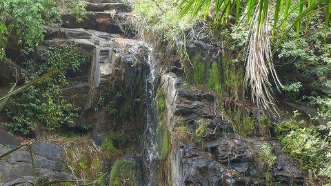
 near Natitingou is a seasonal cascade in the Atakora hills; outside the rainy months the water slows to a trickle and the track is rough.
-
 Benin End to End: Cotonou, the Vodun Coast and the Atakora Hills
Benin end to end: a travel guide for adventurous travellers covering Cotonou, the Vodun coast, the Dahomey palaces, and the remote Atakora hills.
-
 Benin Beyond Cotonou A Route Through Ouidah Abomey and Ganvie
A practical guide to Benin Beyond Cotonou A Route Through Ouidah Abomey and Ganvie.
-
 Natitingou to the Pendjari Gate Bush Taxis Zemidjans and the Road North
A practical guide to Natitingou to the Pendjari Gate Bush Taxis Zemidjans and the Road North.
-
 Mwinilunga Travel Guide to Zambia’s Northwestern Borderlands and Markets
Plan Mwinilunga around its markets and overland routes, with candid advice on transport, accommodation, border access, and connectivity.
-
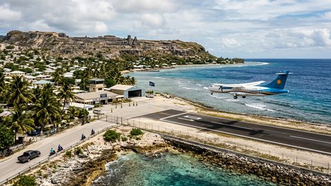 Getting to Nauru, the Pacific State Where Air Schedules Define Your Stay
A logistics briefing on reaching Nauru by air — covering weekly flights from Brisbane and Honiara, visa-on-arrival requirements, and planning around fixed departure dates.
-
 Nauru, the Pacific Republic That Phosphate Built and Nearly Erased
Nauru is one of the Pacific's most overlooked republics. A candid guide to topside, Buada Lagoon, colonial history, and how to actually get there.
-
 Planning Independent Travel in the Wakhan Corridor, Tajikistan
Independent travel in Tajikistan's Wakhan Corridor: GBAO permits, road conditions from Ishkashim, realistic travel windows, and honest logistics for serious overlanders.