Botswana Beyond the Okavango: A Road Trip Through the Country's Towns and History
Botswana is more than the Okavango Delta—its large villages, museums, and long roads reveal a country of deep history and quiet cultural riches.
- Flag
-

- ISO code
- BW
- Population
- 2,254,126
- Currency
- BWP
- Dial code
- +267
Botswana Beyond the Okavango Delta
Most travellers land in Maun, fly over the delta in a light aircraft, spend three nights at a lodge that costs more per person per night than a week in Gaborone, and fly out again. They leave having seen two things: floodplain and game drive. They miss a country where 70 percent of the land is Kalahari sand, where more than 80 percent of the population lives in a corridor barely 200 kilometres wide along the A1 highway, and where the most interesting stories are written in museum courtyards, hilltop palaces, and the quiet space between towns. Botswana beyond the safari circuit is a road trip country. It rewards the traveller who buys a paper map, budgets for long days behind the wheel, and understands that the villages you drive through are not scenic backdrops. They are the point.
- Capital: Gaborone
- Area: 581,730 km²
- Population: ~2.7 million (2024 estimate, Statistics Botswana)
- Population Density: ~4.6 persons/km²
- Kalahari Coverage: ~70% of national territory (south and west)
- Eastern Corridor Population Share: >80% of national population
- Eastern Corridor Width: ~100, 200 km along the A1 spine
- Currency: Botswana pula (BWP, ISO 4217 code). Mid-2026 exchange rate ~BWP 13.5, 14.0 per USD.
- Driving Licence: Valid national driving licence required. International Driving Permit recommended if licence not in English.
- Side of Road Driven: Left
- A1 Highway Route: Ramatlabama border (south) , Lobatse , Gaborone , Mahalapye , Palapye , Serowe , Francistown , Ramokgwebana border (north)
- A1 Highway Length: ~950 km, fully tarred
- Towns Worth An Overnight En Route: Francistown (430 km from Gaborone), Palapye (270 km), Serowe (350 km), Nata (680 km), Kang (500 km on Trans-Kalahari Highway), Ghanzi (700 km), Kasane (1,100 km), Maun (850 km)
The A1 Corridor: History on Tar
Drive the A1 from the Ramatlabama border crossing north toward Francistown. This is Botswana's spine, 950 kilometres of good asphalt that strings together the towns where the country's modern identity was built. You will not see an elephant. You will see something rarer: continuity.
Serowe and the Khama Legacy
Turn off the A1 at Serowe, 35 kilometres east of the highway junction at Palapye. This is one of the largest traditional villages in Africa and the seat of the Bamangwato people. The Khama III Memorial Museum, housed in the old school building that Seretse Khama attended, documents the story of the dynasty that shaped modern Botswana. Khama III, known as Khama the Good, converted to Christianity in the 19th century, forged alliances with British missionaries, and fought to keep the territory from being absorbed into Cecil Rhodes's sphere. His grandson Seretse Khama became Botswana's first president after independence. The museum holds photographs, personal letters from the 1940s marriage controversy that exiled Seretse to London, and a silver tea set used by the royal household. Budget one hour. Then drive 25 kilometres north of town to the Khama Rhino Sanctuary.
The Khama Rhino Sanctuary: Not A Safari
This is a community-managed project on a private reserve, not a national park. The 2024 entry fee for a non-resident adult was BWP 120. You come here to see white and black rhino in a landscape of acacia scrub, not to tick off the Big Five. The driving tracks are sandy and require a vehicle with moderate ground clearance. A 2WD saloon will struggle after rains. Arrive by mid-morning when the rhino are most visible at the waterholes near the main hide. The sanctuary also hosts zebra, giraffe, and springbok, but the point is the rhino. If you want predator sightings, you are on the wrong page.
Palapye: The Stop You Should Make
Palapye sits at the junction of the A1 and the road to Serowe. Most travellers blast through it to reach Francistown. Do not. The town has the most reliable fuel stop between the capital and the north, and the Palapye Hotel serves a plate of seswaa (pounded beef) and sadza that will cost you under BWP 50. More importantly, Palapye is the jumping-off point for the Tswapong Hills. These are not mountains. They are a low sandstone escarpment that rises above the surrounding plains, riddled with caves that hold San rock art. The paintings at Goo-Moremi Gorge are the most accessible. Ask at the Botswana Tourism office next to the post office for a local guide. Negotiate your guide's fee before you start walking. Expect to pay BWP 200 to BWP 300 for a two-hour walk. The gorge itself is a cool, green incision in the baking plateau. It is a short diversion, and it is empty of tourists.

Francistown and the Tati River Valley
Francistown, 430 kilometres north of the capital, is Botswana's second city and the logical overnight stop before continuing east to the Tuli Block or north toward Kasane. It was founded as a gold-mining camp in the 1860s and still carries a frontier feel. The Supa Ngwao Museum on the outskirts documents the history of the Kalanga people and the pre-colonial Tati Kingdom. It is a small museum with a single large hall of artefacts. The real reason to stay in Botswana's old mining hub is the next day's drive.
From the city, take the A33 east toward the Zimbabwe border at Ramokgwebana. Just before the border, turn south onto a gravel road that follows the Motloutse River into the Tuli Block. This is a private wildlife area managed by a consortium of landowners, not a national park. The 2024 entry fees for national parks were BWP 120 per person per day and BWP 50 per vehicle, but the Tuli Block has its own access fees set by individual properties. The draw here is the rock art at the Lepokole Hills, a series of granite outcrops that hold hundreds of San paintings. The most famous panel, known as the 'Dancing Eland,' is on private land at the Limpopo River Lodge. Book access through the lodge in advance. They will charge a day-visitor fee of approximately BWP 250. The paintings are faded, subtle, and almost impossible to photograph well. That is the point. Stand in front of them and you are looking at an artistic tradition that is at least 2,000 years old.
| Site | Location | What You See | Minimum Time | Key Detail |
|---|---|---|---|---|
| Khama III Memorial Museum | Serowe | Photos, letters, artefacts of the Khama dynasty | 1 hour | Entry fee ~BWP 30 (2024); no guide needed |
| Khama Rhino Sanctuary | 25 km N of Serowe | White and black rhino, self-drive | 2-3 hours | Entry BWP 120 (2024); 2WD risky after rain |
| Supa Ngwao Museum | Francistown | Kalanga history and pre-colonial Tati Kingdom | 45 minutes | Entry fee ~BWP 20; small single hall |
| Tswapong Hills rock art | Near Palapye, Goo-Moremi Gorge | San paintings in cave overhangs | 2 hours with guide | Guide fee BWP 200-300; negotiate before walking |
| Lepokole Hills rock art | Tuli Block, near Ramokgwebana border | San panels including 'Dancing Eland' | 1-2 hours | Book through Limpopo River Lodge; day fee ~BWP 250 |
The Roads Between: Kanye, Makgadikgadi, and the Long Drive West
Botswana's cultural sites are not clustered. You drive to them. That is the activity. The A1 corridor gives you the east. The western half of the country demands more time and a 4x4.
Kanye and the Hilltop Museum
Kanye, 80 kilometres southwest of the capital, sits on a ridge above a gorge that runs through the town. The Phutadikobo Museum occupies a 1920s colonial school building on the hilltop. It holds a collection of traditional Bangwaketse artefacts including headrests, beer pots, and the personal effects of Chief Bathoen I. The view from the museum veranda overlooks the entire town and the dry bed of the Kanye River. You can see the rooftops of the kgotla (tribal meeting place) below. Spend 45 minutes here. Do not skip the small display on the 19th-century wars between the Bangwaketse and the Ndebele. It explains why the town is fortified on a hill.
Makgadikgadi Pans: Empty And Full
The Makgadikgadi Pans National Park is not a wildlife spectacle in the way Chobe is. It is a dry salt pan the size of Portugal. The 2024 entry fee for non-resident adults was BWP 120 per person per day. You drive across the pan surface in the dry season (May to October) and feel the absurd flatness. The attraction is not game. It is the scale. From December to March, the zebra migration arrives, but the animals move according to local rainfall, not a schedule. If you want a guaranteed wildlife show, go to Chobe. If you want to stand on a surface where the horizon is a perfect circle and no bird crosses the sky for twenty minutes, go to Makgadikgadi. Stay at the Nata Lodge, just south of the park entrance, which offers basic camping and a swimming pool that matters in October when daytime temperatures hit 36 degrees Celsius.
If You Have A 4x4 And Seven Days
Drive from the capital to Kanye (one hour), then to Serowe (three hours), overnight in town. Day two: Khama Rhino Sanctuary and the Tswapong Hills, overnight in Palapye. Day three: drive to the former gold-mining hub (two hours), spend the afternoon at Supa Ngwao Museum, overnight there. Day four: Tuli Block rock art, overnight back in Francistown. Day five: drive to Nata (three hours), afternoon on the pan edge, overnight at Nata Lodge. Day six: drive to Maun (three hours from Nata via the A3). Day seven: fly out. You will have seen no delta. You will have seen the country.

An Honest Caveat
None of these places are polished. The Phutadikobo Museum has displays behind glass that was installed in the 1970s and has not been cleaned since. The Tswapong Hills guide may not speak English. The Nata Lodge camping ground has shared ablutions that are basic. The drive from Francistown to the Tuli Block takes longer than the map suggests because the last 40 kilometres are gravel that corrugates under any vehicle speed. Botswana beyond the Okavango is not a product designed for tourists. It is a country where buses break down, where the museum curator sometimes does not show up, where the road you planned to take has a cattle grid that shakes your spare tyre loose. That is not a flaw. That is the reason most travellers fly over it.
Common Questions
Do I need a 4x4 for the A1 highway?
No. The A1 is fully tarred for the entire 950 km from Ramatlabama to Francistown. Any 2WD vehicle with reasonable ground clearance will manage. You need a 4x4 if you leave the tarred road for the Khama Rhino Sanctuary after rain, the Tswapong Hills access tracks, the Tuli Block gravel roads, or the Makgadikgadi Pan surface. If you stay on the A1 and the short gravel diversions in the dry season, a 2WD saloon works.
How many days do I need for a Botswana road trip that skips the Delta?
One week minimum. The distances are long by African tar-road standards: Gaborone to Kasane is 1,100 km, a full day of driving each way. A focused cultural itinerary covering Serowe, the Tswapong Hills, Francistown, and the Tuli Block requires five days. Adding Kanye and the Makgadikgadi pushes it to seven. Trying to do both the east and the Kalahari in under ten days means you spend half your trip behind the wheel.
Is the rock art in the Tswapong Hills and Tuli Block well preserved?
The paintings are visible but fragile. The 'Dancing Eland' panel at Lepokole Hills has faded noticeably in the last decade. Direct sunlight, wind erosion, and the occasional tourist touching the surface have taken a toll. Do not touch the paintings. Do not pour water on them to make the images clearer. The Tswapong Hills art in Goo-Moremi Gorge is in slightly better condition because the cave overhangs provide shade. Both sites use local guides who monitor access. Respect their instructions.
What is the best time of year for a non-safari road trip in Botswana?
May to August. The dry season means tarred roads are clear and gravel tracks are hard. Daytime temperatures in the eastern corridor range from 20 to 26 degrees Celsius, which is pleasant for walking. Avoid November to March if you plan to drive on gravel. The single wet season turns unpaved roads into mud slicks, particularly around the Tswapong Hills and Tuli Block. The Makgadikgadi pan surface becomes impassable when wet.
Can I visit these places without booking a tour?
Yes. Unlike the Okavango Delta lodges, which rarely accept direct bookings outside of fixed packages, the cultural sites on this route are self-drive friendly. The Khama Rhino Sanctuary, Supa Ngwao Museum, and Phutadikobo Museum accept walk-in visitors. The Khama III Memorial Museum in Serowe opens Monday to Friday 08:00 to 16:00 and Saturday 08:00 to 13:00. The rock art sites require a guide, but you arrange that on arrival. The only exception is the Tuli Block rock art at Lepokole Hills, where you must book through the Limpopo River Lodge in advance.
Read next
-
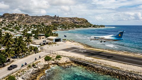 Getting to Nauru, the Pacific State Where Air Schedules Define Your Stay
A logistics briefing on reaching Nauru by air — covering weekly flights from Brisbane and Honiara, visa-on-arrival requirements, and planning around fixed departure dates.
Getting to Nauru, the Pacific State Where Air Schedules Define Your Stay
A logistics briefing on reaching Nauru by air — covering weekly flights from Brisbane and Honiara, visa-on-arrival requirements, and planning around fixed departure dates.
-
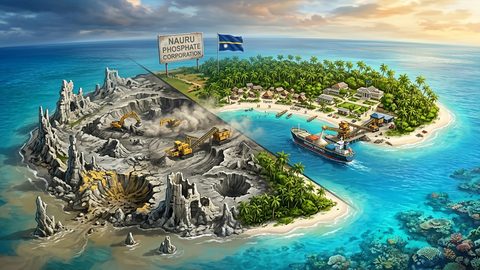 Nauru, the Pacific Republic That Phosphate Built and Nearly Erased
Nauru is one of the Pacific's most overlooked republics. A candid guide to topside, Buada Lagoon, colonial history, and how to actually get there.
Nauru, the Pacific Republic That Phosphate Built and Nearly Erased
Nauru is one of the Pacific's most overlooked republics. A candid guide to topside, Buada Lagoon, colonial history, and how to actually get there.
-
 Planning Independent Travel in the Wakhan Corridor, Tajikistan
Independent travel in Tajikistan's Wakhan Corridor: GBAO permits, road conditions from Ishkashim, realistic travel windows, and honest logistics for serious overlanders.
Planning Independent Travel in the Wakhan Corridor, Tajikistan
Independent travel in Tajikistan's Wakhan Corridor: GBAO permits, road conditions from Ishkashim, realistic travel windows, and honest logistics for serious overlanders.