Nauru, the Pacific Republic That Phosphate Built and Nearly Erased
Nauru is one of the Pacific's most overlooked republics. A candid guide to topside, Buada Lagoon, colonial history, and how to actually get there.
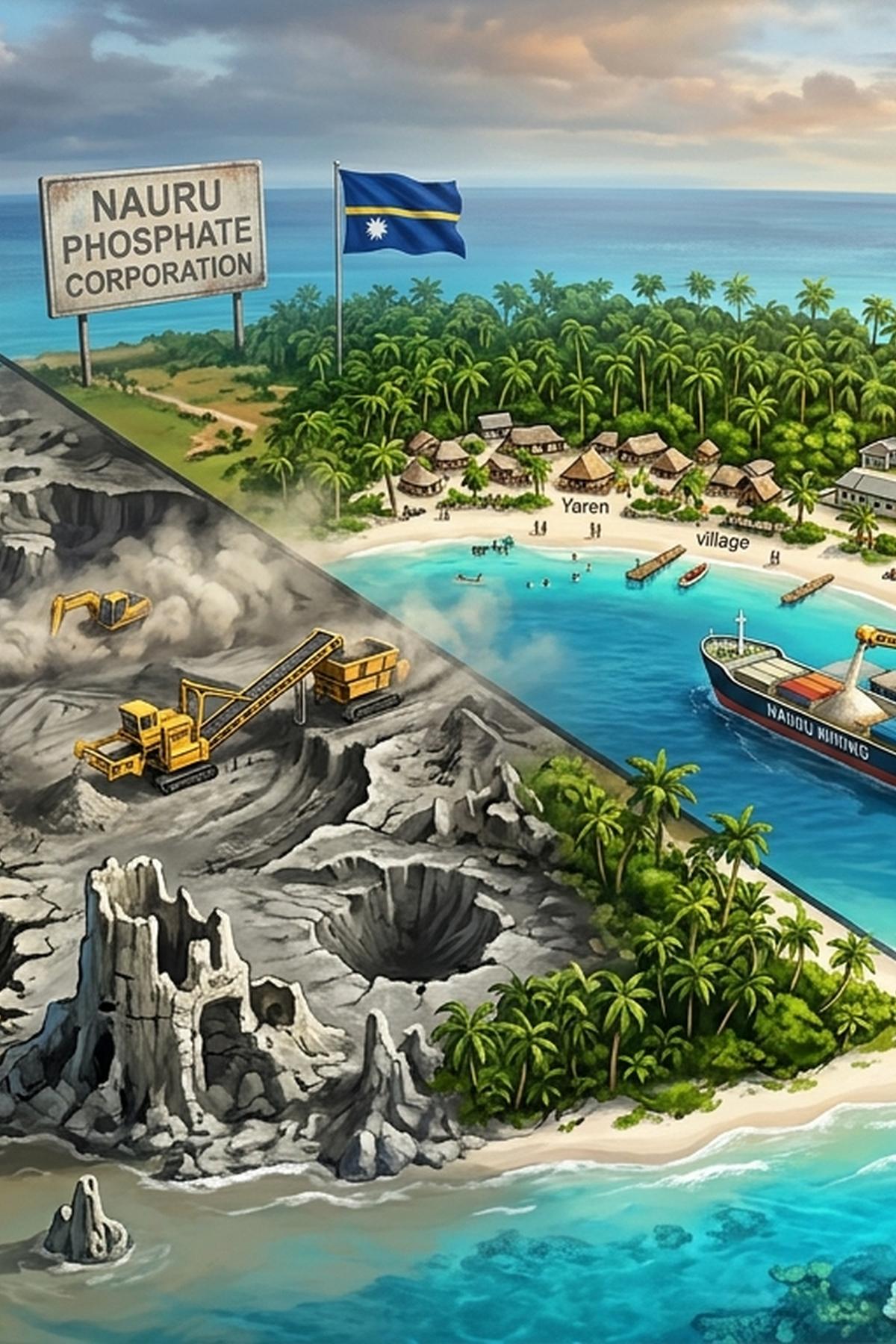
There is a moment, just after the Nauru Airlines Fokker 100 touches down at Yaren, when the landscape outside the oval porthole refuses to resolve into anything familiar. The runway ends close to the sea on one side. On the other, the island's interior rises toward a jagged, pale-grey plateau stripped of topsoil, its limestone pinnacles standing like broken teeth against the equatorial sky. Nothing you have read prepared you for this. That is not because the island is obscure. It is because almost nothing in English has been written about it as a place to visit.
Pacific Realities: Five Things to Know Before You Go
- Nauru covers just 21 km² and has no public transport. Movement is on foot, by bicycle, or in a hired vehicle along a single ring road.
- Nauru Airlines is the only commercial carrier serving the island, routing through Brisbane and, on some schedules, through Honiara in the Solomon Islands.
- Visas are available on arrival for most nationalities, but most guesthouses require advance booking, and that booking confirmation doubles as your immigration sponsor letter.
- Topside, the phosphate-stripped interior plateau, covers roughly half the island's land area and is its most visually and historically significant feature.
- The offshore processing center operates openly on the island. Its fencing, vehicles, and supply chains are part of daily life in a way that cannot be edited out of any honest account of contemporary Nauru.
The Island That Every Pacific Itinerary Skips
Nauru sits in the central Pacific, roughly 53 kilometres south of the equator. It is the world's smallest republic and one of the most geographically isolated inhabited islands on the planet. Its population hovers around 10,000. There is no backpacker trail, no cruise ship anchorage, no resort, and no tourist office. Despite this, or perhaps because of it, Nauru is almost entirely absent from the genre of English-language travel writing.
Even thorough Oceania travel guides tend to skip Nauru entirely, or reduce it to a single contextual line in a regional overview. The traveller who wants more than that will find no working bibliography. There are no recent English-language guidebooks in print, no reliable travelogue chapters, and no blog posts with dated logistics that can be trusted. This is not simply a function of access difficulty. It reflects a pattern in which Nauru has been treated for decades as a policy subject rather than a place, an object of academic and journalistic attention without ever becoming a destination in anyone's published consciousness.
That gap is a serious omission. Few places in the Pacific concentrate so much geological violence, colonial extraction, sudden wealth, spectacular collapse, and contemporary geopolitical complexity into such a small area. For the traveller comfortable building logistics independently from primary sources, Nauru offers one of the last genuinely unmediated island experiences in the region.
How Phosphate Shaped and Scarred a Nation
Nauru's modern history begins with rock. In 1906, a British phosphate prospector identified the island's interior plateau as one of the richest deposits of calcium phosphate in the world. The material was the compressed, fossilised remains of ancient seabird guano, built up over millennia on a raised coral atoll. Extraction began almost immediately under German colonial administration, which had formally annexed the island in 1888.
When Australian forces occupied Nauru during the First World War, they inherited both the island and the mine. What followed was one of the Pacific's most systematic examples of colonial extraction. The British Phosphate Commission, a joint British-Australian-New Zealand body, controlled mining operations through most of the twentieth century. Phosphate left Nauru to fertilize farmland in Australia and New Zealand. Nauruan people received a fraction of what their land produced. When independence came in 1968, the new republic negotiated full control of the phosphate revenue, and the transformation was abrupt. Records tracking Nauru's economic profile show per-capita income that, during the 1970s and 1980s, ranked briefly among the highest in the world.
The government built a hospital, an airline, a shipping line, and invested in real estate across Australia and beyond. Imported food replaced local agriculture. The population grew dependent on phosphate income with no alternative being developed. Then the phosphate ran out.
Nauru's Administrative History in Brief
| Period | Administering Authority | Key Development |
|---|---|---|
| 1888 to 1914 | German Empire | Phosphate identified 1906; extraction begins under German colonial administration |
| 1914 to 1968 | British mandate, then Australian trusteeship | British Phosphate Commission controls exports; UN trusteeship awarded to Australia after 1945 |
| 1968 to late 1980s | Independent Republic (boom years) | Nauru controls phosphate revenue; per-capita income peaks as one of the world's highest |
| Late 1980s to present | Independent Republic (post-boom) | Phosphate reserves effectively exhausted; near-bankruptcy; offshore processing becomes primary revenue source |
Topside: Walking Through the Aftermath of Extraction
The word "topside" is Nauruan shorthand for the interior plateau. It is where the phosphate was. It is, now, where the phosphate was.
Walking across topside is unlike anything else in the Pacific. The terrain is a field of jagged coral limestone pinnacles, called tombstone rock by locals, rising to head height and beyond in places. Between them, the ground is grey and compacted, stained with mineral residue. Scattered across the plateau are rusted remnants of mining machinery, the skeletal frames of cantilever loading infrastructure, and the concrete footings of buildings that no longer stand. The vegetation that has returned is sparse and colonising, pioneer species slowly reclaiming ground that extraction left sterile.
There is no maintained trail and no official tourism infrastructure on the plateau. Visitors who want to cross it do so on their own terms, working through local contacts for access and orientation. The experience sits closer to archaeology than tourism. The silence up there is specific: not peaceful, but abandoned. From the plateau's edge on a clear morning, you can see the ring road below, the narrow coastal strip where all settlement concentrates, and the lagoon glinting in the island's interior depression far below.
Buada Lagoon and the Green Interior That Mining Left Alone
Buada Lagoon is not coastal. It sits inside the island, fed by freshwater seeping through the limestone, and it is the only significant freshwater body on Nauru. The vegetation surrounding it is the densest found anywhere on the island: pandanus, breadfruit, and old coconut palms that predate the mining era. Local families fish the lagoon. Children swim in it. The contrast with topside, reachable in thirty minutes on foot from the lagoon's edge, is sharp enough to feel disorienting.
The ring road runs the full circumference of the island, roughly 19 kilometres, and almost everything a visitor encounters is along this single artery. Residential districts cluster along the coast. Chinese-run general stores supply most of the imported food. The hospital, the parliament building, the airport terminal, and the main guesthouses all sit on or just off this road. A circumnavigation by vehicle takes under an hour without stops. Walking the full circuit is possible in a long day if you begin before the equatorial heat becomes serious.
The phosphate cantilever loading structure at Aiwo, where bulk phosphate was once transferred to ships anchored offshore, remains partly standing and is visible from the road. It is not signposted. It does not need to be.
The Offshore Processing Center as a Fact of Island Life
Nauru entered a new phase of economic dependence in 2001 when Australia established an offshore processing center on the island for asylum seekers intercepted at sea, a policy arrangement that became known as the Pacific Solution. The center closed and reopened several times, and was substantially expanded after 2012. At its peak operation it held well over 1,000 people on an island of roughly 10,000 residents.
The center is not hidden. Its perimeter fencing and support infrastructure occupy a measurable portion of the island's land. The vehicles and personnel associated with its operations, contractors, security staff, and service providers, circulate on the same ring road as everyone else. The Australian dollar, Nauru's currency, flows through the center's supply chain into local businesses, guesthouses, and service providers. For the island's economy in its post-phosphate phase, this revenue stream has no current substitute.
Pretending this infrastructure does not exist would be a form of selective vision. It is part of what Nauru is now. The politics are contested and extensively documented in other forums. What is far less documented is the texture of ordinary life on an island where two very different populations share 21 km² with no possibility of distance between them. That is the ground-level reality a serious traveller will encounter from the first day.
Getting to Nauru and Moving Around Once You Arrive
Nauru Airlines operates the only commercial air service to the island. The airline runs a Fokker 100 on a routing that passes through Brisbane. Depending on the schedule in operation at the time of travel, the route may include a stop at Honiara in the Solomon Islands in one or both directions, making it a practical option for travellers already in Melanesia. Schedules shift seasonally and seat availability is limited. Booking four to six weeks in advance is a reasonable target, and the airline's booking interface, while functional, is not always intuitive for international travellers unfamiliar with Pacific carriers.
Visas are available on arrival for most Western passport holders, but the process requires preparation before departure. Most guesthouses and the island's main hotel will supply a booking confirmation letter that also serves as your immigration sponsor document. Without this letter in hand before you fly, the arrival process can become complicated. The requirement is not hostile; it is procedural. A phone call or email to your accommodation confirmed in writing is sufficient.
Accommodation options are limited in number and not cheap by Pacific standards. The Menen Hotel is the largest established property on the island and has historically hosted Australian government delegations and contractors. Several smaller guesthouses operate in the residential districts, and these tend to offer closer contact with daily island life and lower nightly rates. The island's isolation means every imported good, from food to fuel to maintenance supplies, carries a cost premium. Budget accordingly, and do not expect the range of options available even in far smaller Pacific capitals.
For movement on the island, the practical options break down as follows:
- Walking covers the coastal strip and the approach to topside without difficulty, though the equatorial heat limits comfortable range from mid-morning onward
- Bicycle hire is available informally through guesthouses and local contacts and suits the flat coastal road well
- Hired vehicles with drivers can be arranged through most guesthouses and are the practical choice for a full ring road circumnavigation or for reaching specific sites at topside efficiently
- Informal lifts from local residents are common and freely offered, but cannot form the backbone of any logistics plan
Fuel availability and vehicle supply can fluctuate with the rhythms of island supply schedules. Confirming transport arrangements on arrival, rather than assuming prior correspondence holds, avoids the most common friction point.
What an Exhausted Plateau and 21 km² of Ocean Add Up To
Nauru does not offer the kind of travel experience that resolves cleanly into a single narrative. It is not a ruined paradise and it is not a cautionary tale, though it contains the raw material for both readings. It is a functioning republic working through a genuinely difficult set of circumstances on a small piece of coral and limestone in the middle of the Pacific Ocean, with very few resources and a long institutional memory of what it means to have your land stripped for someone else's benefit.
The traveller who arrives expecting easy beauty will be surprised. The one who arrives with serious interest in compressed history, resource extraction, sovereignty, and contemporary migration politics will find more material in three days here than in three weeks in most Pacific destinations. Topside shows what an industry leaves behind. Buada Lagoon shows what persists through all of it. The ring road, with its mix of local life, contractor vehicles, and imported goods, shows what comes after.
Nauru is one of the few places left where independent travel still means genuinely independent travel: no tours, no infrastructure, no curated version of the place arranged in advance. You piece the island together from what you find on the ground. That is either a problem or the whole point, depending entirely on why you came.
Read next
-
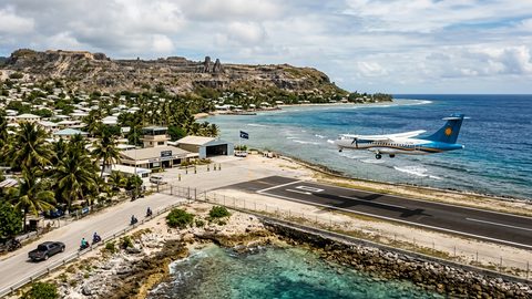 Getting to Nauru, the Pacific State Where Air Schedules Define Your Stay
A logistics briefing on reaching Nauru by air — covering weekly flights from Brisbane and Honiara, visa-on-arrival requirements, and planning around fixed departure dates.
Getting to Nauru, the Pacific State Where Air Schedules Define Your Stay
A logistics briefing on reaching Nauru by air — covering weekly flights from Brisbane and Honiara, visa-on-arrival requirements, and planning around fixed departure dates.
-
 Planning Independent Travel in the Wakhan Corridor, Tajikistan
Independent travel in Tajikistan's Wakhan Corridor: GBAO permits, road conditions from Ishkashim, realistic travel windows, and honest logistics for serious overlanders.
Planning Independent Travel in the Wakhan Corridor, Tajikistan
Independent travel in Tajikistan's Wakhan Corridor: GBAO permits, road conditions from Ishkashim, realistic travel windows, and honest logistics for serious overlanders.