Planning Independent Travel in the Wakhan Corridor, Tajikistan
Independent travel in Tajikistan's Wakhan Corridor: GBAO permits, road conditions from Ishkashim, realistic travel windows, and honest logistics for serious overlanders.
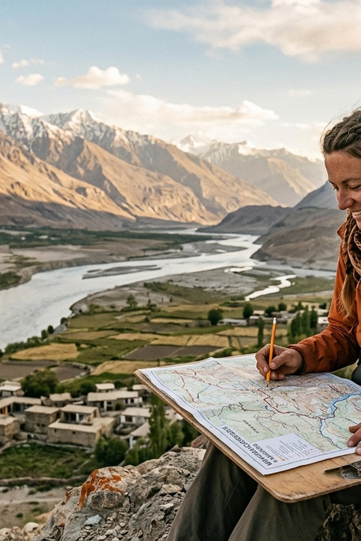
The Wakhan Corridor stops most travelers at the planning stage. It is one of the most geographically isolated strips of land on earth: a narrow Afghan panhandle bracketed by Tajikistan to the north and Pakistan to the south, with the Pamir plateau rising behind it. Tajikistan's side of the valley, accessible from Ishkashim, offers an overland experience that very few people ever complete. The rewards are real , Silk Road-era forts, yurt-dwelling Wakhi communities, and a silence that feels geological. But the logistics are genuinely demanding, and the English-language documentation is thin enough that you will spend more time planning this trip than almost any other route in Central Asia.
The Wakhan is not a trip you improvise , the conditions are specific and the margin for error is real.
- A GBAO permit is mandatory and must be obtained alongside your Tajikistan visa, not on arrival at any checkpoint.
- There is no scheduled public transport in the valley, road surfaces are severe beyond Ishkashim, and the guesthouse network is functional but thin.
- Mobile connectivity becomes unreliable well before Khorog and is essentially absent in the corridor itself , connectivity planning matters most across the broader multi-country route framing this journey.
What the GBAO Permit Actually Involves
Gorno-Badakhshan Autonomous Oblast covers roughly 45 percent of Tajikistan's territory but holds a small fraction of its population. The entire Pamir Highway and the Wakhan Corridor fall within it. Access requires a GBAO permit on top of your standard Tajikistan visa, and this is not a formality you can sort out on the road.
The application process is straightforward. Tajikistan operates an online system for visas and the GBAO add-on is a checkbox in the same form. The combined cost sits around $50 USD, though fees shift periodically and you should verify the current rate through the GBAO permit portal before you apply. Processing typically takes five working days. Print your visa and permit together and carry those copies at every checkpoint , officials along the Wakhan route will check them, and the outcome of that interaction varies enough that you do not want to be caught without documentation.
Citizens of some countries enter Tajikistan visa-free but still require the GBAO permit as a separate document, usually obtained from the State Committee for National Security office in Dushanbe or Khorog. If your passport falls into this category, factor in the additional time and administrative stop before you commit to your dates.
Getting to the Corridor: The Pamir Highway Approach
Almost everyone who reaches the Wakhan from Tajikistan arrives via the Pamir Highway, the M41, which runs from Dushanbe through Khorog before the route splits toward the valley. Khorog, the GBAO capital, is the last real town before the corridor and the last reliable place to stock provisions, withdraw cash, and deal with any vehicle problems. Treat it accordingly.
The drive from Dushanbe to Khorog takes between 10 and 14 hours by shared taxi under good conditions, often longer. Much of the route follows the Panj River, with Afghanistan visible across the water. From Khorog, the road to Ishkashim runs approximately 230 kilometers along the Panj valley and takes another five to eight hours depending on the season and recent road damage.
The geographic scale of the corridor is worth understanding before you arrive. The panhandle stretches roughly 300 kilometers eastward into the Pamirs, with the valley floor rising from around 2,500 meters near Ishkashim to well above 4,000 meters at the far eastern end near the Wakhjir Pass, which borders China. That altitude gain has real consequences for acclimatization. Plan a minimum of two nights in Khorog before pushing into the high sections.
Road Conditions from Ishkashim: Managing Expectations
Ishkashim sits at the western entry point of the Tajik side of the Wakhan valley. The town straddles the border, with a weekend market that has historically drawn traders from both Tajikistan and Afghanistan. The Afghan market may or may not be operating depending on current conditions across the river. Do not build an itinerary around it.
From Ishkashim eastward, the road deteriorates sharply. This is not a surface that a standard sedan can handle without serious risk. High-clearance four-wheel drive is not a preference , it is the baseline. River crossings, rockfall debris, and stretches that become impassable mud after rain are part of the ordinary driving experience. The surface alternates between rutted earth, loose gravel, and short sections of improved track that appear without pattern or warning.
Key settlements along the valley include Langar, Yamg, Vrang, and Zong. Each has at least one homestay or simple guesthouse, but the network is genuinely thin. During July and August, spaces fill. Booking ahead is not realistically possible through any standard channel , lodges are run by local families, and coordination happens through driver contacts or word of mouth from other travelers. Arriving without any local arrangements and expecting to find a bed is a gamble, not a plan.
Choosing the Right Travel Window
The valley is accessible for a narrow slice of the year. Snow closes the upper sections from roughly October through May, and conditions during the shoulder months can strand vehicles for days. The practical window runs from mid-June through late September.
Month-by-Month Conditions in the Valley
| Month | Road Conditions | Weather Stability | Traveler Presence |
|---|---|---|---|
| June | Variable, snow risk on high passes | Improving but unpredictable | Very low |
| July | Generally passable | Good | Moderate (by Wakhan standards) |
| August | Best overall | Most stable | Moderate |
| September | Deteriorating in upper valley | Variable, rain risk increases | Low |
Rain can arrive suddenly and turn the track impassable without warning. Budget extra days at every stage. This is not a journey where tight scheduling makes any sense.
These factors should shape your timing decision:
- Acclimatization time before entering the high-altitude eastern sections , at least two days in Khorog at minimum
- Vehicle readiness and a full-sized spare tire, basic repair kit, and enough fuel for buffer distance beyond planned stops
- Food and water supply for at least three days beyond your planned exit date
- Weather patterns for the broader Pamirs, which give a rough signal for conditions in the valley
- Border status at Ishkashim, which occasionally closes without notice for security reasons on either side
Finding Transport in a Valley With No Schedules
There is no bus service in the Wakhan. There are no minibuses, no taxis waiting at junctions, and no ride-share applications. Transport is entirely informal and relies on either hiring a 4WD vehicle privately from Khorog or Ishkashim, or catching rides with locals heading in your direction.
Hiring a private 4WD with driver from Khorog for the full Wakhan route typically costs between $200 and $350 USD depending on the vehicle, the driver, and the duration. That figure has shifted in recent years with fuel costs, so treat any quoted price as a starting point for negotiation. A driver who knows the Wakhan route specifically is worth paying more for. A driver who has not done it before is a meaningful risk, not an acceptable unknown.
Some travelers piece together the journey by catching lifts from locals , this is possible but slow and unpredictable. You may wait a full day in a village for a vehicle heading your direction. Factor that into your mental model of the trip rather than your calendar.
Connectivity on a Route That Goes Dark Early
Travelers routinely underestimate how early the signal disappears. Tajik SIM cards from operators like Tcell and Megafon provide reasonable coverage in Dushanbe and along the main M41 corridor as far as Khorog, but signal quality degrades significantly south of Khorog and becomes effectively non-existent once you are in the Wakhan valley itself. Navigation, messaging, and emergency contact via local SIM will not be reliable once you leave the Khorog area.
For overlanders doing the broader Central Asia loop, which typically connects Kyrgyzstan, Tajikistan, and often Pakistan or China through a sequence of border crossings, data coverage becomes a multi-country logistics problem rather than a single-country one. Carrying a global eSIM plan that switches between local carriers automatically keeps your device functional across those border-hop segments where a local SIM becomes redundant or unusable. In the Wakhan valley itself, no data solution will help much. But the transit corridors connecting these countries are exactly where reliable connectivity pays off.
Offline maps downloaded before you leave Dushanbe or Khorog are essential. Maps.me and OsmAnd both carry usable coverage of the valley track. A dedicated GPS device with preloaded tracks adds a layer of redundancy that is worth the weight.
What the Wakhan Actually Offers
It is worth being specific about the draws of this journey, because "remote and dramatic" describes half of Central Asia. The Wakhan has particular things that the rest of the Pamirs do not.
The Silk Road fortresses are genuinely striking. Yamchun Fort, perched on a ridge above the valley with views across into Afghanistan, is the most photographed site. Khaakha Fort near Vrang is less visited and more ruined, but the approach walk is more interesting than the main structure. Both date to the period when this valley was a live trade and military corridor between empires.
The Wakhi people who live in the valley maintain a distinct culture from the Tajik population of the lowlands. They speak Wakhi, a separate Iranian language, and practice Ismaili Islam. The Aga Khan development programs have funded schools, clinics, and basic infrastructure throughout GBAO, and their presence in the valley is visible , from rebuilt bridges to community health posts. Travelers who approach communities with patience will find genuine hospitality in the homestays. Those who treat the valley as a backdrop for adventure content will miss the more interesting encounter entirely.
The hot springs at Bibi Fatima, near Yamchun, are a functional stop as much as a curiosity. After days of rough driving and cold nights, the pools carved into the hillside above the river are worth the detour. Most drivers on the Wakhan route stop here automatically.
The Eastern Valley and the Pamir Junction at Langar
The road through the Wakhan connects at its eastern end near Langar with the route coming down from the Pamir plateau via the Wakhan-Pamir junction. This allows for a loop rather than a simple out-and-back. Some travelers enter via Ishkashim and exit south over the Khargush Pass toward the high Pamirs, or reverse that direction. The Khargush route is rougher and requires a vehicle with genuine off-road capability rather than just high clearance.
Beyond Langar, the valley narrows and settlements thin out. Marco Polo sheep habitat begins here, and on a good day you will see herds grazing at altitude. The Wakhjir Pass at the far eastern end is not an official border crossing into China , there is no functioning post there. Some travelers walk toward it for the experience of standing at that geographic extreme, but the area has military sensitivity and your driver's advice matters before you make any plans in this section.
What You Cannot Learn Until You Are Already There
Every serious traveler who has completed this route will say the same thing: published resources are inadequate, conditions change year to year, and the most useful information comes from the most recent travelers. Online forums and overlander communities carry fresher data than any guidebook. The Pamir Highway communities on Facebook, the Caravanistan website, and direct contact with guesthouses in Khorog are your best pre-trip intelligence sources , more so than anything in print.
The Wakhan rewards travelers who arrive with genuine flexibility, adequate preparation, and a real interest in what the valley holds rather than a checklist of coordinates to reach. It will not be comfortable. It will not be fast. The border-crossing framework around this journey adds layers of logistics that each require their own preparation, and the connectivity gaps across those borders are as much a feature of the experience as a frustration to manage.
That preparation is what separates travelers who complete this route from those who turn around at Khorog. The valley has been there for centuries. It will still be there next season. Go when you are genuinely ready, and the effort will return something that very few travel experiences do.