Natitingou to the Pendjari Gate Bush Taxis Zemidjans and the Road North
A practical guide to Natitingou to the Pendjari Gate Bush Taxis Zemidjans and the Road North.
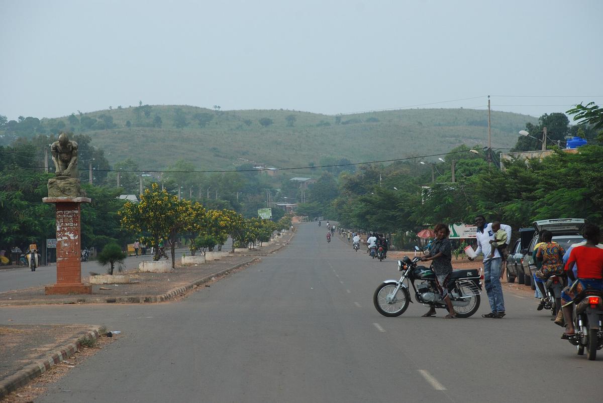

The Road North from Natitingou
The journey from Natitingou to the Pendjari National Park gate is not a single leg but a sequence of moves, each with its own rhythm and equipment. Understanding that sequence before you set out saves time, money and the kind of confusion that can eat a travel day whole. The route runs north on the RNIE3, a paved national road that links Natitingou to Tanguiéta, the last town of any size before the park. From Tanguiéta, the tarmac gives way to tracks that lead to two separate entry points, and the vehicle you chose in town will determine how far you actually get.
Natitingou to Tanguiéta by Shared Transport
The distance between Natitingou and Tanguiéta is approximately 50 kilometres on the RNIE3. In a private vehicle, the drive takes roughly one hour to one hour and thirty minutes, depending on traffic and road conditions. Most travellers, however, make the trip in a shared minibus or bush taxi, known locally as a taxi-brousse. These vehicles connect Natitingou to Tanguiéta and other regional towns and operate on a departure-when-full basis. There is no fixed timetable and no advance booking office. You turn up at the gare routière, find the vehicle heading your way, and wait.
Fares for this segment are not fixed in any published schedule. They are negotiated on the day at the station. The price you pay will reflect demand, the number of passengers waiting, and your own bargaining stamina. As a practical recommendation, ask at your Natitingou accommodation what the going rate has been in recent days before you head to the station. That local intelligence gives you a baseline for negotiation and signals to the driver that you are not arriving completely cold.
Moving Around Town with Zémidjans
Within Natitingou itself, and later in Tanguiéta, the primary means of short-distance transport is the zémidjan, a motorbike taxi. These are the connective tissue of Beninese towns, and you will hear their engines before you see them. Short rides within town cost approximately 200 to 600 FCFA. The price depends on distance, the time of day, and the state of the road you are asking the rider to navigate. Agree on the fare before you climb onto the back of the bike. This is standard practice and avoids the awkward post-ride negotiation that benefits nobody.
Zémidjans are useful for getting between your hotel and the gare routière, for running errands while you wait for a shared vehicle to fill, and for reaching the guidance or vehicle-rental contacts you will need to arrange in Tanguiéta. They are not suitable for the run to the park gates. Do not be tempted to ask a zémidjan rider to take you to Porga or Batia. The track conditions and distance make that impractical, and no rider will agree to it at a price that makes sense.
Tanguiéta as the Jumping-Off Point
Tanguiéta is the gateway town for Pendjari National Park. It is here that the logistical pieces come together. The town has two access routes to the park. The Porga entrance lies on the paved RNIE3 heading north, followed by approximately 7 kilometres of track. The Batia entrance sits to the north-east, reached by roughly 41 kilometres of largely unpaved track. These two approaches are not interchangeable in practical terms. The Porga route is shorter and partly sealed. The Batia route is longer and entirely dependent on track conditions that change with the seasons.
A 4x4 vehicle is strongly recommended, and often essential, for reaching either gate from Tanguiéta. This is especially true for the Batia entrance, where the unpaved surface can deteriorate rapidly during or after rain. The recommendation applies equally to all driving inside the park itself. If you arrive in Tanguiéta by shared minibus, you will need to arrange a 4x4 and driver in town. Rental agencies, lodges and tour operators in Tanguiéta are the standard points of contact. Do not expect to find a rental desk at the gare routière. This is a separate arrangement that requires time and negotiation.
Guides, Fees and the Park Entry
A registered guide is mandatory for all visitors entering Pendjari National Park. This is not a suggestion or an upsell. You cannot drive in unaccompanied. Guides can be arranged in Tanguiéta, at the park gate itself, or through lodges and tour operators. The most reliable approach is to secure a guide in Tanguiéta before you depart for the gate, as this allows you to confirm the arrangement and agree on costs without the pressure of standing at the entry barrier with a vehicle engine running.
The park entry fee for foreign visitors is 10,000 FCFA per person per day. Beninese nationals pay 5,000 FCFA. These fees are distinct from guide fees and vehicle fees, which are separate line items in your budget. The research notes do not provide current figures for guide or vehicle charges, and these are mutable costs that shift with season and demand. Before you travel, verify the current rates directly with African Parks, which has managed Pendjari in partnership with the Government of Benin since 2017. Their official visitor information page is the authoritative source for fee structures. Contacting the park by email is also an option if the website does not answer your question.
Security Considerations for the Journey
No practical transport guide to this route can ignore the security context. As of September 2026, the French Ministry of Foreign Affairs formally advises against all travel to Pendjari National Park and the W National Park, and advises against non-essential travel to the central Atacora department, which includes both Natitingou and Tanguiéta. The stated reason is a proven risk of kidnapping targeting Westerners. The United Kingdom Foreign, Commonwealth and Development Office likewise advises against all travel to Pendjari National Park and adjacent hunting grounds.
These are government advisories, not media rumours. They reflect assessed threat levels and carry consequences for consular support and travel insurance validity. The security situation in the Atacora department and the park is mutable. What was true at the time of the last advisory may not hold when you plan your trip. The responsible action is to consult your own government's travel advisory immediately before making any plans. The French advisory page, with its latest alerts and updates, is one such resource. Cross-reference it with the advice from your own foreign ministry. If the advisory warns against travel, the transport logistics described in the guidance become academic. Do not treat a stable road surface as a proxy for a stable security environment.
A Practical Sequence for the Independent Traveller
Putting the pieces together, a workable sequence looks like this. Start in Natitingou. Use a zémidjan to reach the gare routière. Take a shared minibus or bush taxi to Tanguiéta, negotiating the fare on the spot. The journey on the RNIE3 should take between one hour and ninety minutes once the vehicle departs. In Tanguiéta, arrange a 4x4 and a registered guide. Confirm the guidance's availability and agree on the total cost, including vehicle hire, guide services and any park fees you will pay at the gate. Decide which gate you will use. The Porga entrance involves a shorter track section off a paved road. The Batia entrance involves a longer unpaved approach. Your choice should be informed by local advice on track conditions, which you must verify in Tanguiéta before setting out, especially during or after rains. The park office or your guide can provide that day's ground truth.
This sequence keeps each decision in the right order and in the right place. You cannot book the 4x4 from Natitingou unless you have pre-arranged it through a tour operator. You cannot skip the guidance. You cannot assume the track to Batia is passable because it was dry last week. The road north rewards those who treat it as a series of verifiable steps rather than a single booked itinerary.
Sources and verification
- benin360.com — Research source checked for this guide
- traveldojo.com — Research source checked for this guide
- mustseespots.com — Research source checked for this guide
- benin360.com — Research source checked for this guide
- africanparks.org — Research source checked for this guide
- diplomatie.gouv.fr — Research source checked for this guide
Read next
-
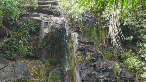
 Kota Falls
 near Natitingou is a seasonal cascade in the Atakora hills; outside the rainy months the water slows to a trickle and the track is rough.
-
 Benin End to End: Cotonou, the Vodun Coast and the Atakora Hills
Benin end to end: a travel guide for adventurous travellers covering Cotonou, the Vodun coast, the Dahomey palaces, and the remote Atakora hills.
-
 Benin Beyond Cotonou A Route Through Ouidah Abomey and Ganvie
A practical guide to Benin Beyond Cotonou A Route Through Ouidah Abomey and Ganvie.
-
 Mwinilunga Travel Guide to Zambia’s Northwestern Borderlands and Markets
Plan Mwinilunga around its markets and overland routes, with candid advice on transport, accommodation, border access, and connectivity.
-
 Getting to Nauru, the Pacific State Where Air Schedules Define Your Stay
A logistics briefing on reaching Nauru by air — covering weekly flights from Brisbane and Honiara, visa-on-arrival requirements, and planning around fixed departure dates.
-
 Nauru, the Pacific Republic That Phosphate Built and Nearly Erased
Nauru is one of the Pacific's most overlooked republics. A candid guide to topside, Buada Lagoon, colonial history, and how to actually get there.
-
 Planning Independent Travel in the Wakhan Corridor, Tajikistan
Independent travel in Tajikistan's Wakhan Corridor: GBAO permits, road conditions from Ishkashim, realistic travel windows, and honest logistics for serious overlanders.