Allada to Abomey the Route Through the Palm Groves and Where to Change Vehicles
A practical guide to Allada to Abomey the Route Through the Palm Groves and Where to Change Vehicles.
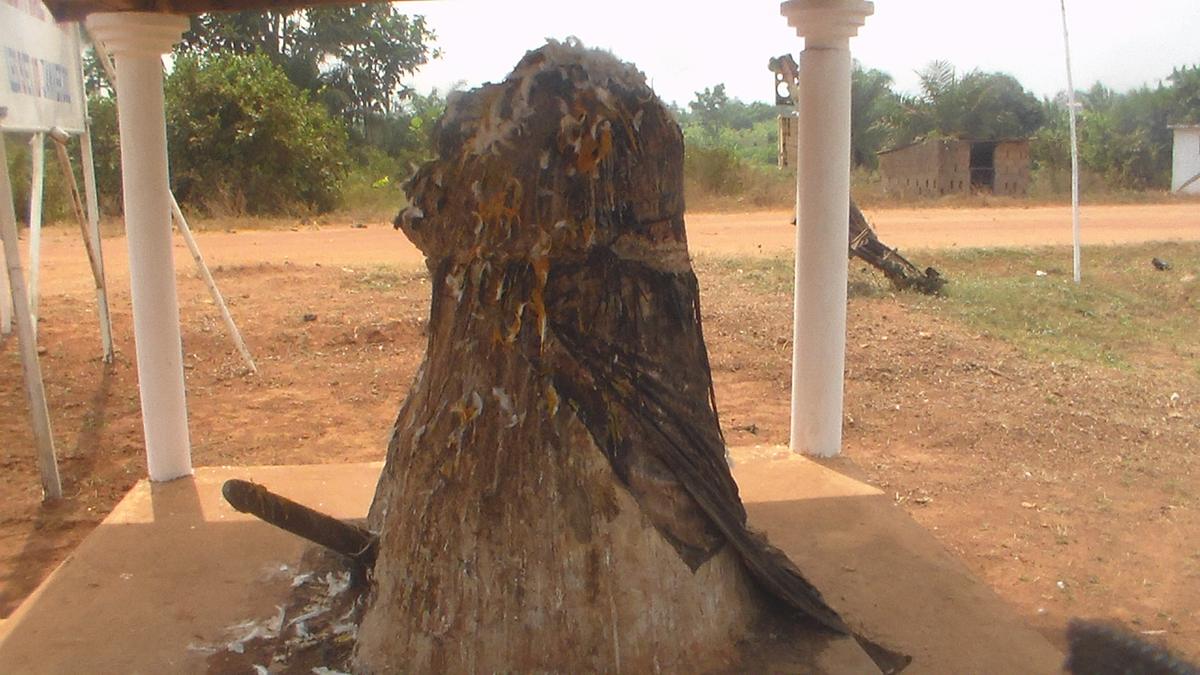

Understanding the Route
The journey from Allada to Abomey follows one of Benin's most important transport corridors, the RNIE2. This national highway stretches from Cotonou all the way to the Niger border, and the segment between Allada and the Abomey area cuts through a landscape shaped by oil palms and red laterite soil. Palm groves line much of the roadside, with agricultural land spreading out beyond them.
The distance from Allada to Bohicon, the gateway town that serves Abomey, is roughly 73 to 74 kilometres. In a private vehicle, that translates to a driving time of about 55 minutes to an hour under normal conditions. But most travellers on this route are not in private cars. Shared bush taxis and minibuses form the backbone of intercity movement here, and they operate on a logic all their own.
Starting at the Allada Gare Routière
Allada has a designated gare routière where northbound transport gathers. This is where shared bush taxis, often the familiar Peugeot 504 break wagons, and minibuses wait for passengers heading toward Bohicon and points beyond. There is no timetable. Vehicles leave when they are full, a system that rewards patience and an early start.
Arriving at the station early in the day gives you the best chance of finding a vehicle that is close to departure. The fare to Bohicon is not fixed in any published sense. It is negotiated in cash, in West African CFA francs, and it moves with fuel prices and demand. The only reliable way to know the going rate is to ask at the gare routière on the day you travel. The drivers and station agents set the price, and confirming it before you board avoids confusion later.
The Road Through the Palm Groves
Once the vehicle pulls out of Allada and heads north, the RNIE2 reveals its character. Oil palms crowd the verges, their fronds casting broken shade onto the tarmac. The soil beneath them is a deep red laterite, a reminder that this highway is carved through some of Benin's most productive agricultural land. The route is direct, with no major towns between Allada and Bohicon, but it is not uneventful.
Roughly 50 kilometres from Cotonou, which places it between Allada and Bohicon, a toll plaza operates at Houègbo. The official fee for a light vehicle is 1,000 FCFA per passage. Some shared-taxi drivers, however, choose to leave the paved road and take unpaved agricultural tracks to bypass the toll. This practice has been documented as hazardous and became more common from early 2026. As a passenger, you may find your driver taking one of these detours. There is no formal mechanism for a traveller to prevent it, but being aware of the possibility helps you understand why a journey might take longer or feel rougher than expected.
Roadworks and Their Effect on Travel
The entire RNIE2 section from Cotonou through Allada and Bohicon onward to Dassa, a stretch of 207 kilometres, is being reconstructed into a dual carriageway. Works were ongoing as of mid-2026. This is a major infrastructure project, and its progress is not uniform. Some segments may be smooth new asphalt, while others could be torn up, narrowed, or diverted.
For anyone planning this journey, the practical step is to check the status of the roadworks before departing. The Ministry of Infrastructure and Transport is the authority responsible, and its public updates, along with reports from drivers who have recently completed the route, are the best sources of current information. Delays and changed road conditions are possible, and allowing extra time is a sensible precaution.
Arriving at Bohicon and Changing Vehicles
Bohicon is not your final destination, but it is where the intercity leg ends. The town lies 9 kilometres east of Abomey and functions as the main road and rail gateway to the historic city. Its central gare routière is the largest bus and taxi park in Benin, a sprawling interchange where passengers arriving from the south must switch to local transport to reach Abomey itself.
There is no direct scheduled bus or fixed-route public transit that runs from Allada all the way into Abomey. The shared bush taxi or minibus you boarded in Allada will terminate in Bohicon. From there, the final leg into Abomey is typically covered by zemidjan, the motorcycle taxis that swarm the station area. The ride takes about 15 minutes. As with the bush-taxi fare, the zemidjan price is negotiated in cash and fluctuates. Confirm the rate with the rider before you climb onto the back of the bike.
Language and Practical Communication
Benin is a French-speaking country, and very few locals speak English. This becomes immediately relevant at the gare routière in Allada, during any interaction with a bush-taxi driver, and again when negotiating a zemidjan fare in Bohicon. Route changes, price discussions, and even basic directions all happen in French.
If you do not speak French, carrying a translation app on a charged phone is a practical workaround. Offline functionality is useful, since mobile data coverage can be patchy along rural stretches of the RNIE2. Learning a handful of French phrases for numbers, directions, and transport terms will also smooth the experience considerably.
Planning Your Journey Step by Step
A clear sequence emerges from how the route actually works. Start at the gare routière in Allada. Find a shared bush taxi or minibus heading to Bohicon and agree on the fare. Wait for the vehicle to fill. Travel north on the RNIE2, passing through palm groves and agricultural land, with a possible toll-bypass detour on unpaved tracks. Arrive at Bohicon's central gare routière. Disembark and find a zemidjan. Negotiate the fare to Abomey. Ride the final 9 kilometres in about 15 minutes.
No step in this sequence runs on a fixed schedule. The bush taxi leaves when full, not before. The zemidjan fare is whatever the market sets that day. The road conditions depend on where the dual-carriageway construction has reached. This is a journey that rewards flexibility and a willingness to ask questions at each stage.
Sources and verification
- beninrevele.bj — Research source checked for this guide
- routeplanner.app — Research source checked for this guide
- visitabomey.com — Research source checked for this guide
- fongbebenin.com — Research source checked for this guide
- rues-benin.openalfa.com — Research source checked for this guide
- visiter-le-benin.com — Research source checked for this guide
Read next
-
 Allada Royal Palace
The Allada royal palace is a living court an hour from Cotonou where the king still receives visitors, with strict protocol and a small museum.
-
 Benin End to End: Cotonou, the Vodun Coast and the Atakora Hills
Benin end to end: a travel guide for adventurous travellers covering Cotonou, the Vodun coast, the Dahomey palaces, and the remote Atakora hills.
-
 Benin Beyond Cotonou A Route Through Ouidah Abomey and Ganvie
A practical guide to Benin Beyond Cotonou A Route Through Ouidah Abomey and Ganvie.
-
 Mwinilunga Travel Guide to Zambia’s Northwestern Borderlands and Markets
Plan Mwinilunga around its markets and overland routes, with candid advice on transport, accommodation, border access, and connectivity.
-
 Getting to Nauru, the Pacific State Where Air Schedules Define Your Stay
A logistics briefing on reaching Nauru by air — covering weekly flights from Brisbane and Honiara, visa-on-arrival requirements, and planning around fixed departure dates.
-
 Nauru, the Pacific Republic That Phosphate Built and Nearly Erased
Nauru is one of the Pacific's most overlooked republics. A candid guide to topside, Buada Lagoon, colonial history, and how to actually get there.
-
 Planning Independent Travel in the Wakhan Corridor, Tajikistan
Independent travel in Tajikistan's Wakhan Corridor: GBAO permits, road conditions from Ishkashim, realistic travel windows, and honest logistics for serious overlanders.